Franklin Moves Over the Dominican Republic With Torrential Rains
Tropical storm Franklin continues to move over this territory with torrential rains and to the north.
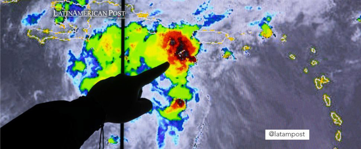
A meteorologist from the Emergency Operations Center (COE), delivers information to the press about storm Franklin, today in Santo Domingo (Dominican Republic). Tropical storm Franklin is approaching Hispaniola on Tuesday and threatens to leave floods and landslides in its wake on both the Haitian and Dominican sides, while storm Harold was downgraded to a tropical depression as it advanced through southern Texas, reported the US National Hurricane Center (NHC ). EFE/Orlando Barria
EFE
Escucha este artículo
Leer en español: Franklin se mueve sobre República Dominicana con lluvias torrenciales
Tropical storm Franklin, which made landfall this Wednesday morning on the southern coast of the Dominican Republic, near Barahona, continues to move northward with torrential rains over this territory, the US National Hurricane Center (NHC) reported.
The storm, which came ashore with maximum sustained winds of 50 miles per hour (85 km/h), has weakened in recent hours and is now packing winds of 40 miles per hour (65 km/h).
The center of Franklin is expected to cross Española Island on Wednesday and emerge over southwestern Atlantic waters in the afternoon or evening. At 11:00 local time (15:00 GMT), Franklin was about 65 miles (100 km) south-southwest of Puerto Plata, in the Dominican Republic, and was moving at 13 miles per hour (20 km/h) in a northerly direction.
A motion to the north-northeast followed by a turn to the northeast and east-northeast is expected on Thursday. Tropical storm warnings are in effect for the south coast of the Dominican Republic, from the border with Haiti east to Cabo Engaño and the south coast of Haiti from Anse d’Hainault east to the border with the Dominican Republic and the Turcos and Caicos islands.
No major changes in the intensity of Franklin are expected as it crosses the island of Hispaniola, but a gradual strengthening is expected starting Thursday and as its center advances over Atlantic waters. Tropical storm force winds extend eastward up to 105 miles (165 km) from the center.
Franklin is expected to produce rainfall totals of 6 to 12 inches (152 to 304 mm) through Thursday with higher amounts around 16 inches (406 mm) mostly along central Hispaniola. Rainfall of up to 4 inches (101 mm) can occur in Haiti, with storm total maximums of 8 inches (203 mm).
Minor coastal flooding is also possible along the coast of Hispaniola in areas of offshore winds.
Harold dissipates
On the other hand, NHC meteorologists expect Tropical Depression Harold to dissipate during this Wednesday, although flood watches are still in effect for parts of Texas and New Mexico.
At noon today Harold was located 155 miles (245 km) southeast of El Paso (Texas) and was moving over the eastern state at 24 miles per hour (39 km/h) and heading northwest, according to the latest bulletin. dedicated to this cyclone issued by the American meteorological center.
It dumps up to 4 inches (101 mm) of rain in western Texas and northern Mexico.